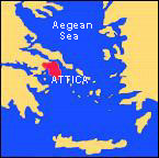
 An area of countryside in central Greece. From the later 8th century on it became increasingly dependent on and governed from Athens and populated mainly by farmers but with wealthy villages and important local sanctuaries. The area included Piraeus, the port of Athens, and the sanctuary sites at Eleusis, other major centres being Sunium and Laurium, the site of silver mines. The major geographical features are Mt Parnes, Mt Pentelikon (with marble quarries) and Mt Hymettos.
Above: Map of Greece and the Aegean © Beazley Archive, Ian Hiley


